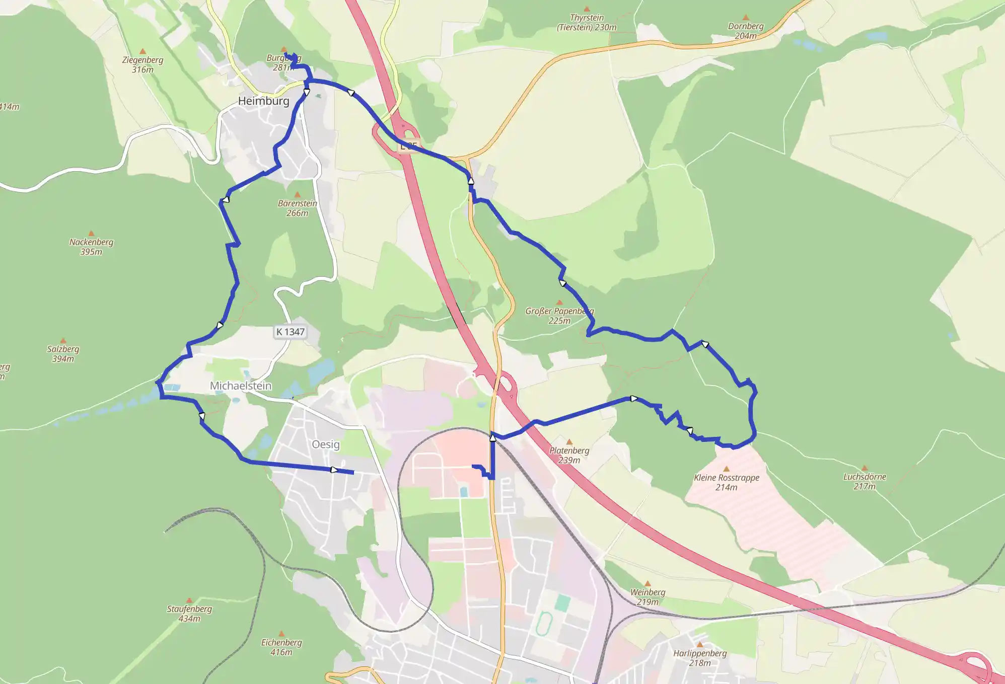
Distance 12.84 km
Est. duration 03h 49m
Elevation Gain 313 m
Elevation Loss 286 m
Category Hiking
Description

No description for now...
Route
Start
Lerchenbreite
51.80645, 10.94253PKW Ladestation CCS 300kW 4Stk, 34, Lerchenbreite, Oesig, Blankenburg, Landkreis Harz, Saxony-Anhalt, 38889, Germany
1.74 km
HWN080 Burgruine Regenstein
51.81386, 10.95835Raubgrafentunnel, Blankenburg, Landkreis Harz, Saxony-Anhalt, 38889, Germany
3.20 km
HWN081 Sandhöhlen im Heers
51.81721, 10.96584Alte Heerstraße, Blankenburg, Landkreis Harz, Saxony-Anhalt, 38889, Germany
4.61 km
HWN082 Regenstein-Mühle
51.81653, 10.94883Mühlgrabenweg, Oesig, Blankenburg, Landkreis Harz, Saxony-Anhalt, 38889, Germany
7.90 km
HWN084 Altenburg
51.82693, 10.911307 Gerichtslinden, Am Teiche, Heimburg, Blankenburg, Landkreis Harz, Saxony-Anhalt, 38889, Germany
11.17 km
HWN059 Klostergrund Michaelstein
51.80498, 10.90977Michaelstein, Blankenburg, Landkreis Harz, Saxony-Anhalt, 38889, Germany
12.84 km
Waldfriedenstraße
51.80373, 10.931321A, Waldfriedenstraße, Oesig, Blankenburg, Landkreis Harz, Saxony-Anhalt, 38889, Germany
12.84 km
Finish