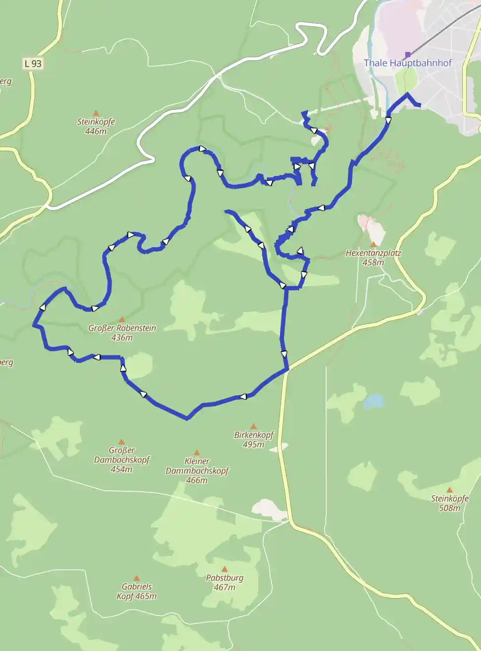
Stempelrunde Thale Bodetal 178,72,70,68
April 23, 2026
by @dennis
Thale, Saxony-Anhalt, Germany
Easy
Distance 18.17 km
Est. duration 03h 54m
Elevation Gain 959 m
Elevation Loss 727 m
Category Hiking
Description

No description for now...
Route
Start
51.73335, 11.01808
51.74205, 11.032521.68 km
HWN178 Hirschgrund
51.73363, 11.01775Hirschgrund, Thale, Landkreis Harz, Saxony-Anhalt, 06502, Germany
2.88 km
51.73095, 11.01377
51.73095, 11.013774.03 km
51.72966, 11.01813
51.73134, 11.024554.69 km
51.72748, 11.01681
51.72748, 11.021335.34 km
51.72862, 11.01293
51.72862, 11.012936.28 km
HWN070 Prinzensicht
51.73372, 11.00740Hirschgrund, Thale, Landkreis Harz, Saxony-Anhalt, 06502, Germany
7.36 km
51.72744, 11.01519
51.72610, 11.014997.60 km
51.72098, 11.01513
51.72414, 11.014437.95 km
51.72100, 11.01518
51.72119, 11.014958.54 km
51.71701, 11.00247
51.71857, 11.008759.07 km
HWN068 "Pfeil"-Denkmal
51.71732, 11.00223L 240, Thale, Landkreis Harz, Sachsen-Anhalt, 06502, Deutschland
9.75 km
51.72008, 10.99456
51.72006, 10.9951910.03 km
51.72195, 10.99376
51.72206, 10.9936610.53 km
51.72169, 10.98805
51.72186, 10.9871011.10 km
51.72457, 10.98263
51.72457, 10.9826311.36 km
51.72721, 10.98657
51.72651, 10.9845811.76 km
51.72583, 10.98890
51.72588, 10.9881412.09 km
51.72635, 10.99182
51.72671, 10.9920112.46 km
51.73010, 10.99180
51.72987, 10.9916912.66 km
51.73124, 10.99370
51.73094, 10.9934712.87 km
51.73176, 10.99644
51.73181, 10.9957913.25 km
51.73033, 10.99701
51.73065, 10.9986413.60 km
51.73252, 11.00203
51.73252, 11.0020314.28 km
51.73844, 11.00266
51.73760, 11.0022214.65 km
51.73815, 11.00558
51.73815, 11.0055815.03 km
51.73554, 11.00832
51.73563, 11.0082215.72 km
51.73560, 11.01862
51.73656, 11.0137517.64 km
51.73752, 11.01836
51.73932, 11.0190318.17 km
51.73778, 11.01573
51.74156, 11.0177918.17 km
Finish